Get updates from The Developer straight to your inbox Yes, please!
East Leeds Orbital Route, Leeds for Leeds City Council with AtkinsRéalis, Knight Architects and Balfour Beatty
East Leeds Orbital Route, Leeds for Leeds City Council with AtkinsRéalis, Knight Architects and Balfour Beatty
The East Leeds Orbital Route redefines infrastructure as landscape-led design. Conceived through co-design with local communities, it delivers on its bold vision: a country park with a road running through it. The 7km green corridor connects existing neighbourhoods and future planned communities, integrating walking, cycling, and equestrian routes within a biodiverse setting of meadows and woodland. ELOR accommodates movement and ecology, creating a resilient, inclusive environment that enhances well-being and celebrates place. This landmark scheme exemplifies how infrastructure can shape sustainable, community-led landscapes.
Describe the context of this project, its neighbourhood and people.
The East Leeds Orbital Route forms the eastern boundary of Leeds and underpins the East Leeds Extension, one of the UK’s most ambitious residential growth initiatives. Designed to unlock land for over 5,000 new homes, ELOR addresses critical challenges of housing demand, congestion, and connectivity. Yet its vision goes far beyond transport, it is a landscape-led green corridor that integrates infrastructure with nature and community wellbeing.
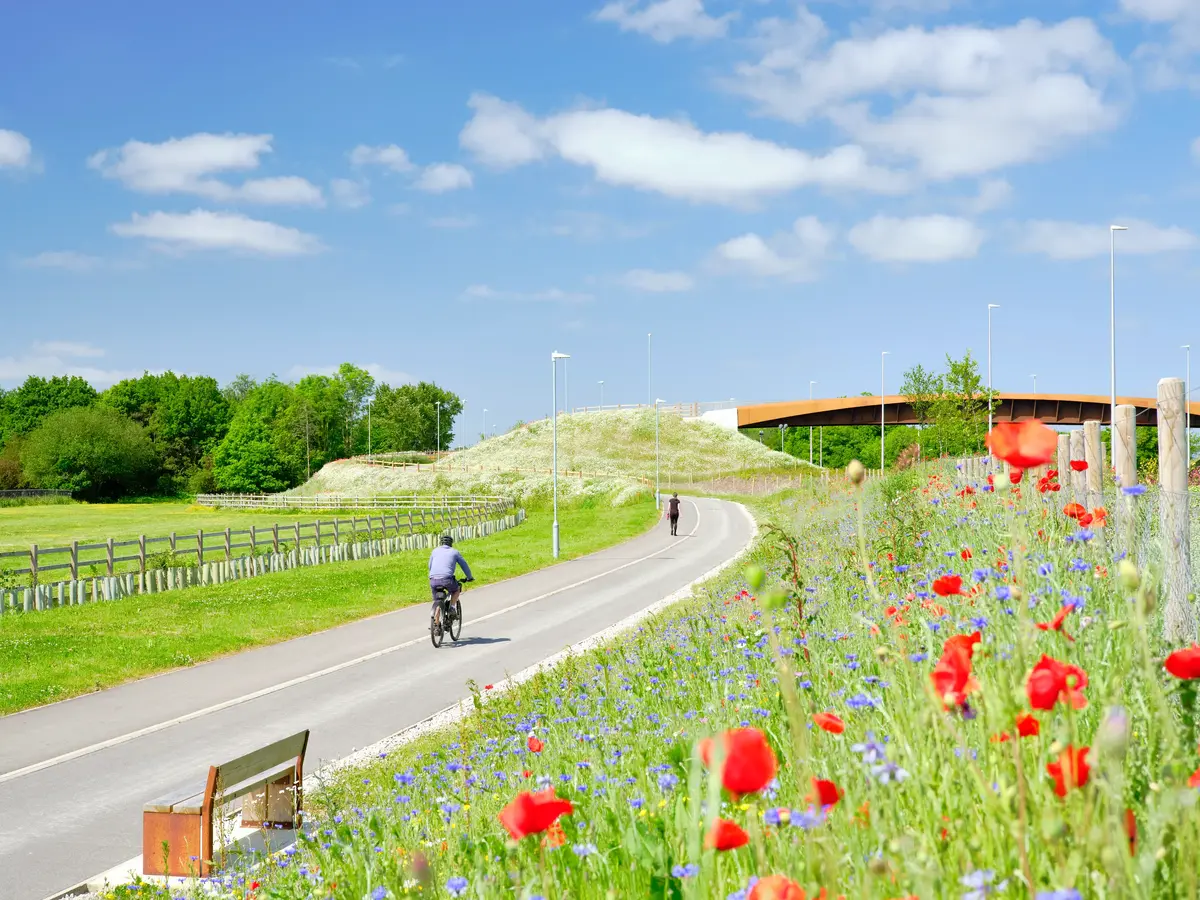
Spanning 7.5km, ELOR connects the A6120 Ring Road to the A58 at Thorpe Park, linking new and existing neighbourhoods to employment hubs and the city centre. The design prioritises inclusivity and accessibility, delivering multi-use paths for walking, cycling, and equestrian use, alongside pocket parks, outdoor gyms, and play features that encourage active lifestyles.
Serving both established communities and future populations within the East Leeds Extension, ELOR was shaped through extensive consultation to reflect local aspirations for safe, attractive, and sustainable spaces. By embedding green infrastructure, heritage interpretation, and active travel networks, the scheme creates a linear parkland that fosters social interaction, recreation, and ecological stewardship. Woodland screening, wildflower meadows, and habitat corridors enhance biodiversity and climate resilience, transforming a transport route into a living landscape.
ELOR exemplifies how infrastructure can deliver more than movement. It creates a connected, inclusive environment that strengthens community identity and sets a new benchmark for landscape-led design. This is not just a road; it is a catalyst for sustainable growth and a country park with a road running through it.
Tell us what you did and how it was designed and delivered.
The East Leeds Orbital Route (ELOR) forms the eastern boundary of Leeds and underpins the East Leeds Extension (ELE), one of the UK’s most ambitious residential growth initiatives. Conceived as a “road within a country park,” ELOR was guided by Leeds City Council’s vision and delivered through a collaborative governance model involving the Council, AtkinsRéalis’ multi-disciplinary design team, Balfour Beatty, and local stakeholders. This partnership ensured strategic alignment with housing growth objectives, national policy goals, and funding viability.
The design embedded a landscape-led approach, integrating infrastructure with topography, hydrology, and cultural heritage. Spanning 7km, ELOR connects the A6120 Ring Road to the A58 at Thorpe Park, linking existing neighbourhoods with future communities. Multi-use paths for walking, cycling, and equestrian use sit alongside pocket parks, play features, and outdoor gyms. Five signature corten steel bridges provide east-west connectivity and serve as sculptural landmarks.
Community engagement was central to delivery. Workshops, exhibitions, and digital platforms informed decisions on path alignments, play areas, and planting palettes. Local schools participated in tree-planting activities, fostering environmental awareness and ownership. Balfour Beatty published CONES and Building Bridges, a children’s book introducing construction safety and diversity themes.
Sustainability principles underpinned construction: reuse of excavated material for bunds, adaptive planting for climate resilience, and SuDS for water management. Extensive green infrastructure and biodiversity enhancements transformed a transport corridor into a linear parkland, unlocking land for 5,000 homes while creating a connected, inclusive environment. ELOR sets a benchmark for collaborative, landscape-led infrastructure delivery.
What is the social and environmental impact of the project?
ELOR delivers transformative benefits for East Leeds, socially and environmentally. Socially, it creates a connected, inclusive landscape that links existing communities and future neighbourhoods within the East Leeds Extension. A network of multi-use paths for walking, cycling, and equestrian use connects homes to schools, workplaces, and leisure destinations, reducing car dependency and promoting active travel. Pocket parks, outdoor gyms, and “play on the way” features encourage health, wellbeing, and intergenerational activity. Heritage interpretation at Barnbow provides a living memorial, strengthening cultural identity and education. Extensive community engagement including workshops and school tree-planting activities fostered local ownership and pride.
Environmentally, ELOR embeds green infrastructure at scale: 12 hectares of wildflower meadows, 4.5km of hedgerows, 2.5 hectares of woodland, and over 35,000 trees create a biodiverse corridor that enhances ecological networks and supports pollinators. Sustainable Drainage Systems (SuDS) including swales, ponds, and basins manage stormwater, reduce flood risk, and form wetland habitats. These interventions improve air quality, mitigate urban heat, and strengthen climate resilience.
By prioritising active travel and reducing congestion, ELOR contributes to cleaner air and carbon-conscious growth. Its design aligns with UN Sustainable Development Goals, demonstrating how infrastructure can be a catalyst for biodiversity, healthier lifestyles, and inclusive placemaking. ELOR is not just a road it is a multifunctional green corridor that transforms connectivity, enriches nature, and sets a benchmark for sustainable infrastructure.
Sign up to our newsletter
Get updates from The Developer straight to your inbox
Thanks to our organisation members
© Festival of Place - Tweak Ltd., 124 City Road, London, EC1V 2NX. Tel: 020 3326 7238